Day 6 - Oban / Ferry to BARRA (Castlebay)
page 6

This morning, I looked out on yet another grey day, a sky full of low cloud barrelling along on a potent westerly. Was I really going to head into the teeth of this dispiriting, unpleasantness? Rain drops battered themselves against the hostel windows and raced each other to the bottom.
Visibility was about an arm’s length; Oban is a dull, nondescript place at the best of times. In the worst of times, like now, with its horizontal rain, it’s a bloody miserable place ‘guie drecht’ as the locals might say. Anyway, breakfast is on the boil (the usual bucketful of porridge) while I ponder the fate of my cycling partner. . . probably murdered during the night by his roommates while searching for his cutlery pack or worse. . .errm ...worse than dead???
Chris did appear and reassured me that his health problems were now non-existent. I pointed out the slight problem that now existed, if it were to re-occur on the islands, then he could not have chosen a worse place. The issue was his to deal with, in the end, it cleared the air. We were now ready for the central purpose of this expedition.
It was outside, while loading up the bikes that I noticed a difference to Chris. This was day six of our trip, without exception, every time we stopped and set off again, I found myself sitting on the bike waiting for him to stop fiddling, (he seemed to take twice as long to put his padlock away, for instance). Today was different; today he seemed to make a point of being first off and then stopping after a few yards to wait for me. I didn’t say anything, it showed a certain keenness, and I certainly would not be complaining. We quickly added another half mile to the total amount, and we were at the ferry about 45 minutes before departure. The ferry was busy getting ready, long, umbilical pipes were attached from it to the shore and seemed to be pumping life into it. Trolleys of foodstuffs were being wheeled on; people were like worker bees to the Queen. I stood and watched this, admiring the logistics of it all. Meanwhile, Chris busied himself chatting up a female passenger of a certain age. Ah, things were back to normal!
Soon we were watching Oban disappear into the mist, and we made our way up the Sound of Mull for our five-hour journey to the Outer Hebrides. This part of the journey is very scenic, well, when it’s not raining, that is. Which is what it did until we passed Ballamory on our left, which used to be known as Tobermory. Soon on our right was the Ardnamurchan Lighthouse, mainland Britain's most westerly point. The ferry stopped at Coll and Tiree. Both islands looked superb in the sunshine, yes, sunshine! Despite their flatness, the shoreline and rock formations are captivating. These are, of course, treeless islands with not a hill of any significance in sight. What, however, dominates your thoughts about these places is: what on earth is it like in the wintertime?
Most of the very few passengers on board disembarked here, leaving us and another couple on this huge ferry to continue on its journey to Barra. We were now in the open sea and spent time discussing the navigation plotter which was on display in the lounge. We saw the mouse pointer working over it, clearly showing that this was no customer-sanitised version but a real-time image of what was on the bridge. We eventually came close to the island of Vatersay before swinging in a gentle curve and into Castlebay. The sky was overcast, but I could still appreciate the beauty of the scene.
The houses of Castlebay (the most unoriginal named place in the whole of Britain) hugged the side of the bay while towering above was the island’s highest mountain, Heaval, at 1,260 feet.
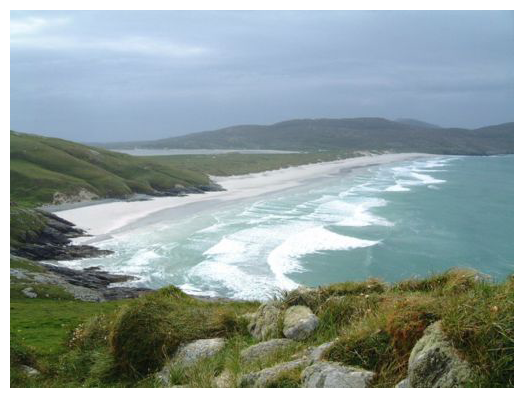
West Beach, over in the distance of the isthmus is Barra airport having its runway washed by the tide.
A Special Island
Barra just has a single road ringing the island with occasional dead-end side roads off it. We had planned to spend the night on the beach on the north of the island but that was only 10 miles from Castlebay, so we decided to do a bit of island bagging. With that in mind, we set off to 'bag' one of the smaller ones - Vatersay, linked by a causeway at the south of the main island. The islands south of here evoke nostalgic memories within Scottish hearts with names like Mingulay, Pabbay, and Sandray. There was quite a steep climb out of Castlebay and at the top of the hill was a wonderful view over the island and beyond.
There is also a very striking war memorial with an awful lot of names on it, mostly sailors, of course. Considering the population of this island has never been more than a thousand, the list appeared to show that at least half the male population had at some time been killed during both wars.
The first part was up a road steep enough to earn a chevron on the map, and we really couldn’t be bothered destroying our legs, so we took the bikes for a walk up the hill and zoomed down the other side. Once on the island, it soon became clear that flat-looking on the map isn’t the same as flat-looking on the ground. There is a lot of up and down you can squeeze into a 10 metre contour interval, and if you do it enough times, that’s quite a lot of climbing, that is how the Vatersay roads work. So, after a bit more exercise than anticipated, we arrived at the beautiful beaches of West Bay and Vatersay Bay. The only significant thing we did was post our cards in the most westerly post-box in Britain. Going by the state of it and its isolation we must have been the first to use it for several years. The cards were actually delivered in normal time, I can’t believe that the postman opens it up every day, but he did on this occasion. Half a day out there on your own, and they send search parties and choppers, and you become a minor ‘filler’ on the late news.
Getting back to Barra, was a lot easier, as the wind was behind us. We headed around the west side of the island in the belief that there were fewer hills to climb. It’s a beautiful place, but quite bleak in many respects. The Isle of Barra is the smallest of the islands we visited, it was my favourite, the island is not lacking in character, that’s for sure. We camped at the world-famous Barra airport; this airport has a unique runway, only available twice a day when the tide is out. Planes land on the huge Northbay where the sand forms a concrete-like surface.
We're Talking Rubbish!
Our chosen site was among the dunes with sea views both east and west, although we did need to pitch our tents on the lee of a large container. This was for Fire Brigade use and was their emergency store for potential plane crashes. I’ve never heard of an incident yet at Barra airport, so let’s hope that will remain so for the next 12 hours.
After a rather nice meal of pasta and something, we headed off for a walk along the west-side beach. There was a beach on the east side of our camping spot as well, and they were about a mile apart. Towards the end of the walk, we were greeted by a glorious sunset which was duly snapped adding to the million other glorious sunsets I’ve seen over the years. Whilst walking along the beach which, unlike all other westside beaches in Britain (except Orkney and Shetland), genuinely faces the Atlantic with uninterrupted views of the good old US of A.
Anyway, Chris ended up at the end of a walk with a large armful of flotsam plastic. Plastic waste being a particular bugbear with him and, to his credit, he managed to pick up about .001% of the total visible plastic on this beach. Doing this on a remote beach in the Outer Hebrides does present a small problem, mainly, in its subsequent disposal. It was not very thoughtful of the Highlands and Islands Council not to provide a recycling bin. If there had been one, I do concede the wind would have ensured it would not be long before it also ended up in the sea as plastic waste. Anyway, the people at the airport terminal would have been surprised in the morning at the sudden appearance of a small mountain of plastic on their doorstep. I suspected though, that all Chris succeeded in doing was transferred it from the West Beach to the East Beach.
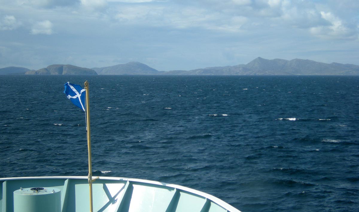
After 5 hours we approach Barra
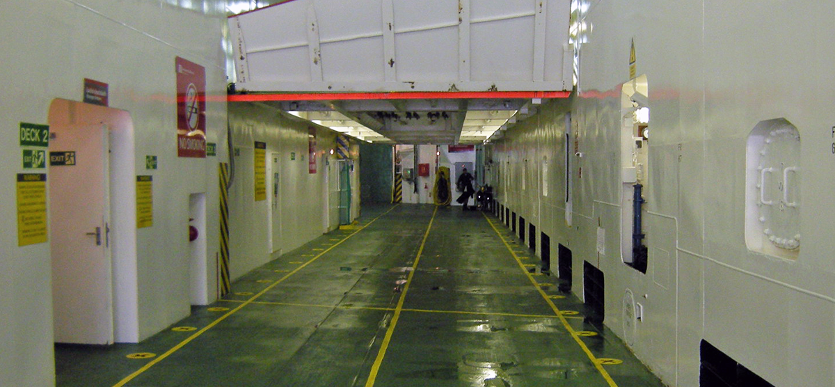
All that way to carry two bikes.
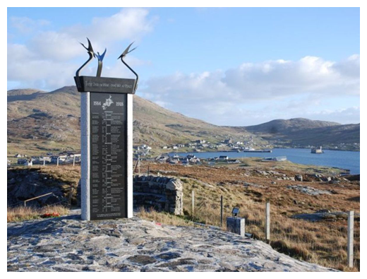
War memorial looking over Castlebay.
No one is fool enough to choose war instead of peace - in
peace sons bury fathers, but in war fathers bury sons.
Herodotus
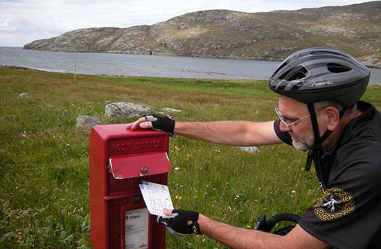
Remote postbox.
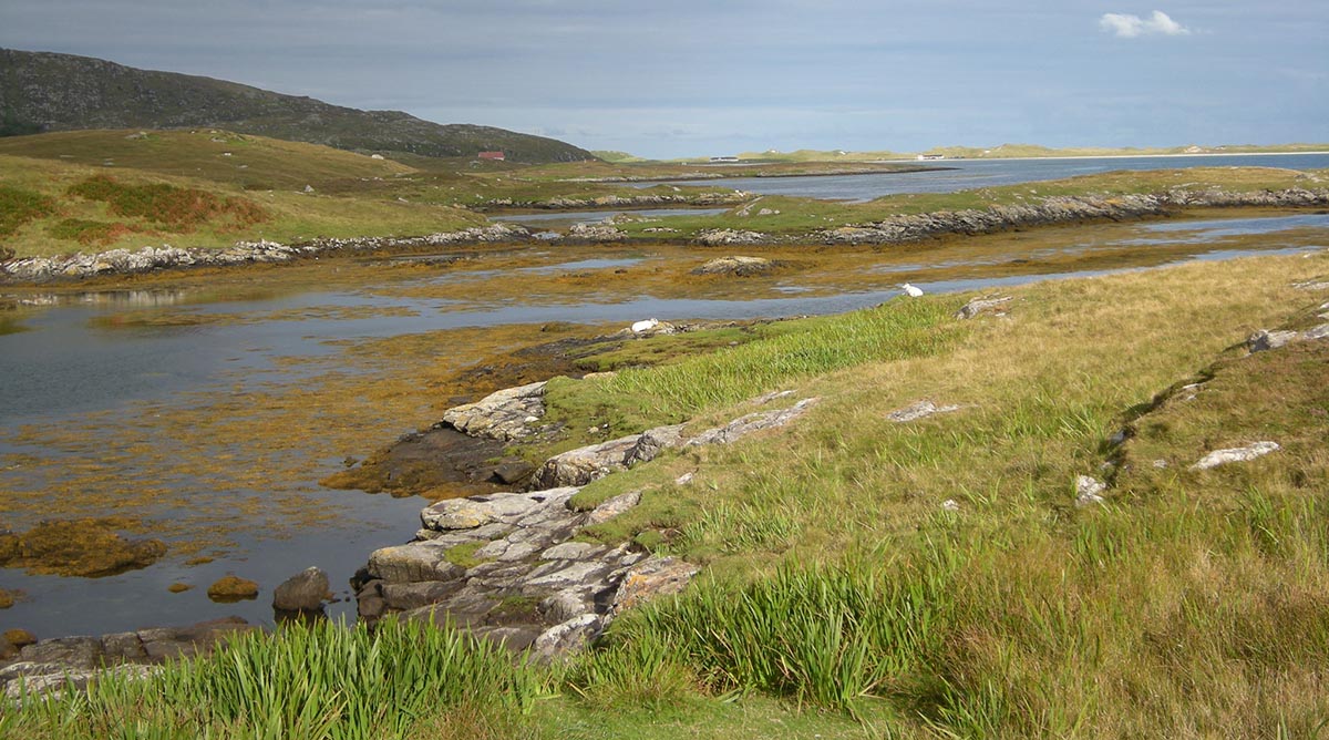
Typical Barra shore inlet
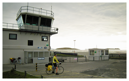
Barra airport
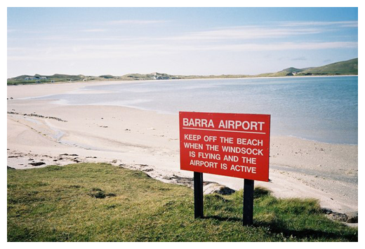
Passenger aircraft land on the beach
